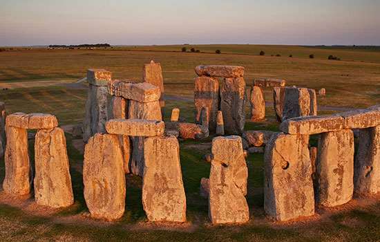
Research on Stonehenge
Stonehenge has been the subject of speculation, theory and research since the Middle Ages. Our understanding of the monument is still changing as excavations and modern archaeological techniques yield more information. Yet there are many questions that we have still to answer.
Here we take a look at 400 years of research on Stonehenge, from the first known excavation to the very latest discoveries.
Antiquarian interest
The first known excavation at Stonehenge, in the centre of the monument, was undertaken in the 1620s by the Duke of Buckingham, prompted by a visit by King James I.[1] The king subsequently commissioned the architect Inigo Jones to conduct a survey and study of the monument. Jones argued that Stonehenge was built by the Romans.[2]
The antiquary John Aubrey surveyed Stonehenge in the late 17th century, and was the first to record the ring of pits later named after him, the Aubrey Holes.[3] His studies of stone circles in other parts of Britain led him to conclude that they were built by the native inhabitants, rather than Romans or Danes as others had proposed. As the Druids were the only prehistoric British priests mentioned in the classical texts, he attributed Stonehenge to the Druids.
Aubrey’s idea was expanded by the 18th-century antiquary William Stukeley, who surveyed Stonehenge and was the first to record the Avenue and the nearby Cursus. Among Stukeley’s theories about Stonehenge, he too thought it was a Druid monument.[4]
Early excavations and survey
In 1874 and 1877 Sir William Flinders Petrie surveyed Stonehenge in detail, and devised the numbering system for the stones that is still in use today.[5]
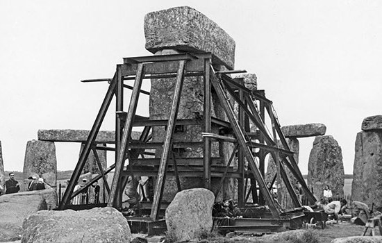
Concerns about the stability of the stones (especially after one of the sarsen stones and its lintel had fallen down) led to the straightening of a large leaning trilithon in 1901. Professor William Gowland directed excavations around the base of the stone, and based on the finds, he proposed a late Neolithic or early Bronze Age date for Stonehenge.[6]
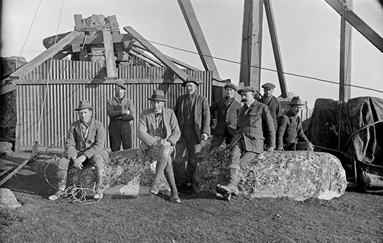
A further programme of restoration and excavation, led by Lieutenant-Colonel William Hawley, was carried out between 1919 and 1926,[7] when most of the south-eastern half of the monument was excavated.[8]
Read more about Stonehenge’s early archaeologistsRestoration and research
Between 1950 and 1964 Richard Atkinson, Stuart Piggott and JFS Stone undertook a new campaign of excavations, partly to resolve some unanswered questions left by Hawley and partly in response to a large programme of stabilisation and re-erection works at the monument.[9] Atkinson proposed a three-stage chronology for Stonehenge.[10] No detailed archaeological report was completed but the excavations were published in 1995.[11]
Excavations in 1966–7 in advance of new visitor facilities led to the discovery of Mesolithic pits or postholes in the car park.[12] The ‘Stonehenge Archer’ burial was found in the ditch in 1978,[13] and a trench dug alongside the old A344 revealed a new stone hole, a possible partner to the Heel Stone.[14]
In the wider landscape, survey work was undertaken by the Royal Commission on Historical Monuments (England),[15] and a programme of fieldwalking and excavation, the Stonehenge Environs Project, was completed.[16]
A decade of digging
From 2002 there was renewed interest in investigating the Stonehenge landscape, particularly on the eastern side of the World Heritage Site. Excavations in 2002 to the south of Amesbury, 3 miles (5km) from Stonehenge, led to the discovery of the Amesbury Archer. He had lived in Continental Europe before being buried in the earliest Bronze Age with gold objects, the earliest ever found in Britain.[17] Many other important burials and a late Neolithic pit or post circle were also found.
Much excavation took place in the Stonehenge landscape as part of the Stonehenge Riverside Project (2003–9), a major study led by Professor Mike Parker Pearson. This aimed to test the hypothesis that Stonehenge was linked to the ceremonial timber and earth complex at Durrington Walls via the river Avon.
The archaeologists found a roadway or avenue linking the Southern Circle at Durrington Walls to the river, as well as several small houses and structures built of timber and chalk. Analysis of the animal bones and pottery from this settlement has provided new insights into the feasting, rituals and movement of the people who built and used Stonehenge.[18]
The project also investigated the Greater Cursus, Amesbury 42 long barrow, Cuckoo Stone and Stonehenge Avenue.[19]
As part of the project, excavation took place in 2008 at Stonehenge to retrieve cremation burials which had been re-interred within Aubrey Hole 7. Analysis of the remains has shown that they represent more than 50 people, both male and female and of various ages. These people were buried at Stonehenge between about 3000 and 2800 BC.[20] Studies of their bones showed that not all had been living within the local area during the last ten years of their lives, suggesting that people may have brought their cremated dead to Stonehenge from some distance away.[21]
In the same year (2008), as part of the SPACES project (Strumble-Preseli Ancient Communities and Environmental Study), Professor Tim Darvill and the late Geoffrey Wainwright opened a small trench within the stone circle.[22] This revealed surprising evidence for Roman activity at Stonehenge – the Romans had dug a large pit or shaft there. The SPACES project also uncovered further details of the previous settings of the bluestones.
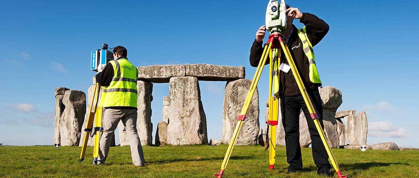
Landscape and laser survey
Between 2009 and 2013, research teams at English Heritage (now Historic England) undertook detailed analytical earthwork surveys of all the major monuments in the World Heritage Site, including Stonehenge. All their research reports are available to download. These surveys revealed much new information about the form and phasing of sites and were accompanied by new historical aerial photography and geophysical surveys.
Part of this project included a laser survey of Stonehenge, which revealed more Bronze Age carvings on the stones, and new information about the way the stones had been shaped.[23] Parchmarks spotted in the grass during a hot spell in the summer of 2013 led to renewed debate about whether the sarsen stone circle was completed.[24]
Also in 2013 the old A344 road bed was removed, revealing traces of the Avenue ditches and a small part of the Heel Stone ditch.
Within the wider landscape, two large-scale geophysical surveys uncovered details of both known monuments and new sites, including round barrows, small henges and two large pits within the Greater Cursus.[25]
Recent research
The last few years have brought exciting discoveries. In 2017 a new causewayed enclosure – an early Neolithic monument comprising circuits of segmented ditches – was uncovered at Larkhill, to the north of Stonehenge, during excavations before the building of new army housing.
Then in 2020 the Stonehenge Hidden Landscapes Project announced the discovery of a large circuit of shafts, possibly natural sinkholes or artificial pits, surrounding the henge monument at Durrington Walls.[26] Later in the year, researchers using a novel geochemical approach analysed a core extracted from Stonehenge to pinpoint the probable origin of the giant sarsen stones as West Woods, 15 miles (25km) north, on the edge of the Marlborough Downs.[27]
More recently, a new bluestone monument arc or circle at Waun Mawn in the Preseli Hills has been discovered.[28] Its similarities to Stonehenge are intriguing. They include the shape and size of the unspotted dolerite stones, the potential alignment of the ‘gunsight’ entrance on midsummer solstice and the overall diameter of the monument. Empty stoneholes suggest that at least six bluestones were removed from this site at some point in prehistory, and it seems likely that at least the three existing known unspotted dolerites at Stonehenge were brought from here.
Finally, researchers examining the DNA of early Bronze Age people buried in the Stonehenge area have found close genetic relations between people buried in cemeteries at Porton Down, Wilsford and Amesbury Down.[29] These appear to be groups of related people who came over from continental Europe and continued to inter-marry among themselves, separately from the local Neolithic population.
Future research questions
Stonehenge and its surrounding landscape are a continuing focus for intense archaeological research, both by academic teams and in advance of commercial development. There are many questions about Stonehenge that we have yet to answer. A set of research questions for the monument and the wider World Heritage Site is set out in the Stonehenge WHS Archaeological Research Framework.
An air of mystery and intrigue will always surround Stonehenge. Over the last 20 years, however, our understanding has moved on dramatically – each new piece of evidence has brought answers and established further questions. The story of Stonehenge continues to evolve and change.
Find out more
-
History of Stonehenge
Read a full history of one of the world’s most famous prehistoric monuments, from its origins about 5,000 years ago to the 21st century.
-
Building Stonehenge
Stonehenge is a masterpiece of engineering. How did Neolithic people build it using only the simple tools and technologies available to them?
-
100 years of care
In 1918, Cecil and Mary Chubb gifted Stonehenge to the nation. Our series of blog posts traces the conservation and care of Stonehenge over 100 years.
-
Archaeologists of Stonehenge
We take a look at some of the archaeologists who have contributed to our understanding of Stonehenge, from the 17th century to the present day.
-
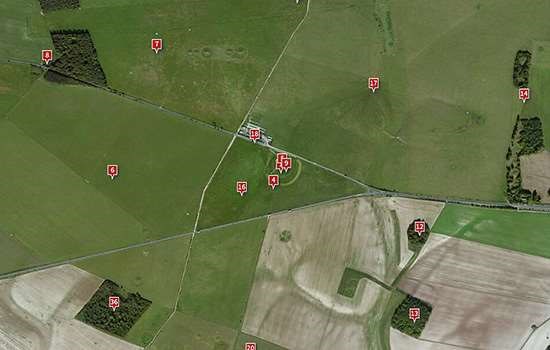
The Stonehenge World Heritage Site Landscape
Explore this interactive map created by Historic England to find out about the latest in-depth research into the Stonehenge World Heritage Site landscape.
-
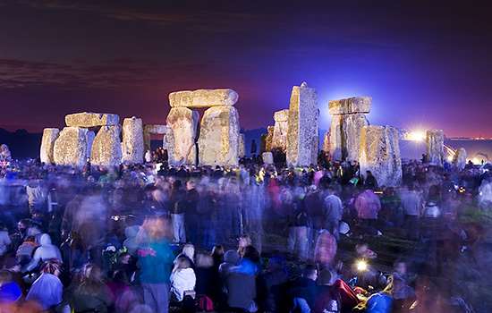
Why Does Stonehenge Matter?
Stonehenge is a unique prehistoric monument, lying at the centre of an outstandingly rich archaeological landscape. It is an extraordinary source for the study of prehistory.
-
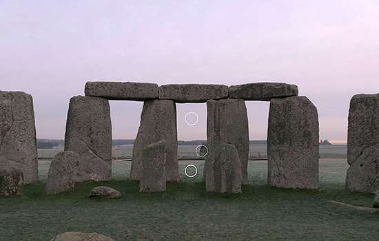
Virtual Tour of Stonehenge
Take an interactive tour of Stonehenge with this 360 degree view from inside the stones, which explores the monument’s key features.
-
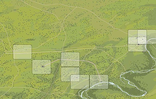
Explore the Stonehenge Landscape
Use these interactive images to discover what the landscape around Stonehenge has looked like from before the monument was built to the present day.
-
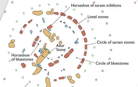
Plan of Stonehenge
Download this PDF plan to see the phases of the building of Stonehenge, from the first earthwork to the arrangement of the bluestones.
-
More histories
Delve into our history pages to discover more about our sites, how they have changed over time, and who made them what they are today.
Footnotes