History of Hob Hurst’s House
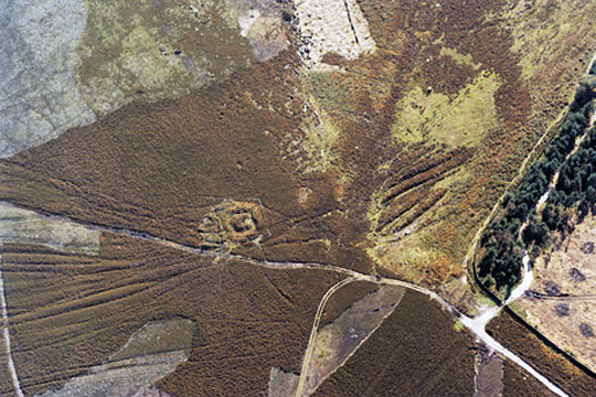
This site lies high on the gritstone moorlands of Harland Edge, above Beeley in the Peak District, reached from the nearest road by a stiff uphill walk of about 2km (1.25 miles).
The word ‘hob’ – meaning a sprite, bogey or hobgoblin – features in many Peak District place names. This place may have been known locally as belonging to ‘Hob o’ th’ Hurst’.

Description
The monument comprises a rectangular mound measuring 8 x 7.5 metres (26 x 25 feet) retained by drystone walling.
Surrounding the mound are a steep-sided ditch and low outer bank, which at its crest measures 16 x 16.5 metres (52 x 54 feet). The ditch may be a later feature, from a time when stone was taken from the site to build nearby drystone walls. On the north side the bank has been damaged by a packhorse track.
At the centre of the mound is a rectangular cluster of stones, measuring 3.5 x 2 metres (11.5 x 6.5 feet) internally.
Although the stones might have functioned as a burial chamber, with the spaces between them spanned by capstones, they might also have been designed as an open setting.
Thomas Bateman excavated the site in 1853 and found evidence of a cremation, and two pieces of galena, or lead ore, surrounded by an arc of small stones.
Many of the barrow mounds in the Peak District are known to date from the Bronze Age, although the unusual form of this example has led some to suggest that it might be significantly later, perhaps of Iron Age date.


