Hadrian’s Wall is the most remarkable Roman monument in Britain, running 117km (73 miles) from England’s east coast to west coast. But interestingly, the Roman road that runs along its southern side is a rare example of a non-straight Roman road! Hadrian’s Wall, and its Scottish cousin, the Antonine Wall, were positioned to maximize natural high ground. The roads linking the forts and settlements were forced to follow suit. But across the rest of the country, most Roman roads are straight. Well, straight-ish.
Here’s a handy guide to help you spot Roman roads in the landscape.
Direction
16,000 km (10,000 miles) of Roman roads were built in Britain between AD43 and AD150. Before the invading Roman army arrived in AD43 there were already some long-distance trackways across Britain. But the Romans needed to move soldiers, supplies and heavy wheeled vehicles across the land quickly, even in wintery, wet weather. And they needed to demonstrate who was in charge.
Most of the 40,000-strong Roman invasion force in AD43 landed in Richborough, Kent. From there, the troops moved north and west across England, towards Wales and eventually into Scotland. The initial invading forces used existing Iron Age tracks, or struck out cross-country on open ground. But once soldiers had secured a location, surveyors and road builders quickly followed behind.
Roman roads are straight – in sections. Surveyors aimed to link military and civilian sites as directly as possible, but with scope to adjust for difficult terrain, steep hillsides and other natural obstacles like cliffs and rivers. It’s a myth that they ploughed through whatever terrain the straight line took them through. The Romans were pragmatic!
High Street Roman road in the Lake District, Cumbria. The modern footpath heads to the summit of the hill. The Roman road contours round to the west (right hand side in the picture). Roman roads weren’t always straight if there was a practical reason to add a curve! | Image: Mary-Ann Ochota
Each section, a few miles long, was linked with the next section, but they could be slightly offangle to each other. The Romans probably surveyed and created a map first, then plotted out the route of the road. Roman surveyors tended to favour high ground in hilly areas, rather than valley bottoms – the land would be drier, and ambush less likely. Unnecessary summits would be avoided however – efficiency was everything.
See if you can spot points where the Roman road changes direction, and if there’s a reason why (to avoid a hill, or cross a river, for example).
Drainage and Surface
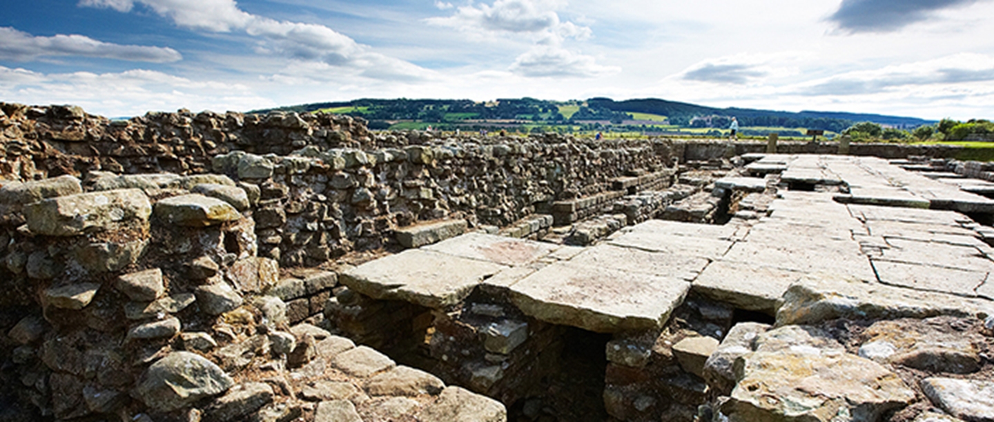
To create a hard-wearing road surface, Roman construction gangs would first dig out two shallow, U-shaped ditches on either side of the road. They would then use the excavated earth to build up a central cambered mound, the agger. On top of the agger, a foundation layer of large stones or cobbles would be rammed into the earth, and on top of that a finer layer of gravel or pebbles would be compacted to form a hard, durable surface. These are metalled roads, from the Latin metallum, meaning ‘quarry’. In particularly boggy ground, archaeological excavations have shown that the builders laid the road over a brushwood platform, effectively creating a metalled road sitting on a floating platform.
If you think you might be on a section of Roman road, see if you can spot the raised agger and any surviving metalling. Rough, metalled sections of otherwise unsurfaced footpaths or bridleways may indicate a Roman origin.
On some routes Roman metalling has survived for more than 1,800 years | Image: Mary-Ann Ochota
Traces of roadside ditches may survive, although they’ll mostly be filled in and silted up. Look for slight linear depressions, or a change in vegetation (taller, greener, different plants) that may indicate softer, wetter soil.
You can sometimes spot original stone-lined drainage channels, known as culverts, that run under the road surface, and kerb stones. There are also some rare survivals of Roman milestones too – often tucked into hedgerows or even reused as gateposts! These large stone cyclinders were originally 1 Roman mile apart (1,480m) – which was officially 1,000 double paces.
Width
Most Roman roads were built so that animal-drawn carts could pass one another comfortably. The standard width of a two-way metalled road was 20 pedes (Roman feet, measuring just under 12in/30cm each). One lane of the modern M1 is 12 pedes wide.
Roman roads that are still in use as modern roads are likely to have been widened, but sections that are now footpaths or bridleways can give an idea of the original width. If you can identify the original verge lines and ditches, you’ll be able to estimate the original road width in pedes.
Placenames
Names can give clues about a place’s Roman origins. Names ending with -caster, -chester, or –cester (from the Latin castrum, meaning ‘military camp’) are Roman. For example, there’s Lancaster, Manchester, Leicester, Gloucester. Places starting with Car- and Caer- (for example, Carlisle) also derive from this. If you have two places with Roman names, there must be at least one road linking them.
The famous names of Roman roads themselves have absolutely no Roman origin. Watling Street, Fosse Way and Stane Gate were all named by Anglo-Saxons and Vikings, long after the Romans had left. Stane Gate is Norse for ‘Stone Road’. Waclinga Stræte (Watling Street) is the road (‘Stræte’) to Waclinga’s land, likely a Saxon settler near St Albans. We don’t know what the Romans called these roads, it’s possible they used ‘classic’ road names, like Via Appia, or more prosaic names based on destination, like Via Deva (Chester Road).
The other great place to spot Roman roads is on a map
Modern Ordnance Survey maps will mark known sections with ROMAN ROAD, but there are many more miles that aren’t marked. You may be able to trace the route partly as a modern road, then dropping in and out of visibility along the line of tracks, parish boundaries or field lines.
There are some red herrings out there. This straight, raised ‘agger’ is actually a disused railway track. | Image: Mary-Ann Ochota
There are no roads of comparable quality constructed either before, or for more than a thousand years after, the Romans. However, if dateable material isn’t found in the road or its associated features (like pottery, coins or other artefacts), it can be surprisingly difficult to date a road beyond all reasonable doubt.
The roads that are most likely to feel straight enough to be Roman, but aren’t, are recent bypass roads, early modern turnpike roads from the 1700s, or roads created when common lands were enclosed during the 18th and 19th centuries. Disused railway lines and some raised field boundaries can sometimes be sneaky red herrings too!
Find out more about the Romans
CHECK OUT OUR TRAVEL GUIDE:
PLAN A VISIT TO A ROMAN SITE:
- Hadrian’s Wall (Northumberland and Cumbria)
- Wroxeter Roman City (Shropshire)
- Lullingstone Roman Villa (Kent)
- Richborough Roman Fort and Amphitheatre (Kent)
Or find a Roman site to visit in England near you


