History of Burgh Castle Roman Fort
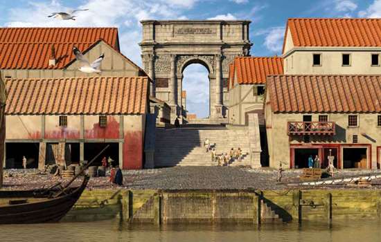
The Roman sites at Burgh and at nearby Caister-on-Sea were part of a string of forts along what is known today as the Saxon Shore, extending between the Solent and the Wash. These ‘Saxon Shore forts’ are thought to have acted as a defensive system against seaborne raiders, as naval bases and as defended trading centres. Extensive cropmarks at Burgh Castle do indicate an extensive vicus (civilian settlement) outside the fort walls.

The Count of the Saxon Shore
According to a late Roman document, the Notitia Dignitatum, listing all military and civil service commands in the Roman empire, these forts were under the authority of ‘the Count of the Saxon Shore’. It also tells us that Burgh’s garrison was the Stablesian cavalry unit. While this information may be correct, the date of compilation of that part of the Notitia covering the western empire in the later 4th or earlier 5th centuries is uncertain, so when and for how long these details applied is not known.
In the 4th century AD Burgh and Caister controlled the entrance to the Waveney estuary, which is characterised by extensive marshes. They probably operated together and one, or both, were known by the Romans as Gariannonum.
For more than half a century the Saxon raids were checked fairly successfully and it was not until AD 367, when the Saxons, Picts and Scots made a concerted attack on Britain, that the forts began to be overrun and the count was killed.
Bede records that in about AD 630 Sigeberht, King of the East Angles, gave land inside a Roman fortress to St Fursa to found a monastery. The site, which was called Cnobheresburh, may have been Burgh – there is evidence for Saxon occupation and a cemetery inside the fort at this time. Caister is also a likely candidate, however. It too was the site of Saxon activity from the 7th century, and there was a large Saxon cemetery to the south of the fort.
It is worth visiting both sites to get a good impression of these Roman forts – Burgh for its still imposing defences and striking location, and Caister for the evidence of its internal streets and buildings.
Description
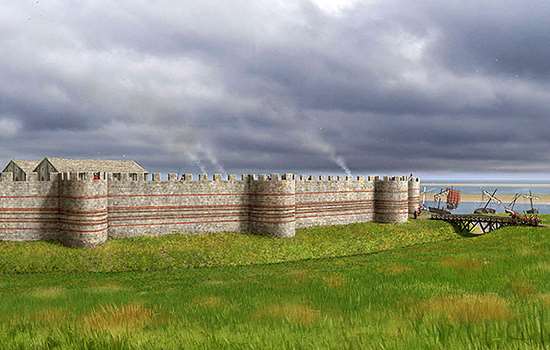
Burgh Castle Roman Fort is one of the best-preserved Roman monuments in the country. Built in the late 3rd century AD on a low cliff above the Waveney estuary, its substantial walls are an impressive sight.
Today the main route into the fort is the eastern gate. The west wall has long since tumbled into the marshes, with the result that the drama of entering the fort is increased by the panoramic view across Breydon Water.
Originally enclosing an area of about 2.4 hectares (6 acres), the walls of the fort were around 3.5 metres (11 ft) wide at the base and taper to 1.5 metres (5 ft) at their full height of around 4.5 metres (15 ft). They were further fortified, at a late stage in the construction, by projecting towers or bastions. Each has a central circular hole, either for anchoring catapults called ‘ballistae’ or to support timber watchtowers that may have been linked along the top of the walls. You can see this feature more clearly on the bastion that has fallen outward from the south wall.
Over the centuries the walls have been plundered for building material, exposing the mortared flint rubble core, but they were originally faced inside and out with cut flint and tile in alternating bands. A well-preserved stretch of this facing survives along the outside of the south wall.
Inside the south wall and at the north-east corner of the fort are the remains of deep socket holes, probably the site of lean-to buildings or gantries, but other than this little is known of the fort’s interior layout.
After the Norman Conquest, Burgh was used as a motte-and-bailey castle. The walls enclosed the bailey and a motte and ditch were constructed in the south-western corner. You can clearly see where the ditch has breached the south wall, though the mound itself has long since been levelled.
In the 19th century quarrying for the nearby brickworks further ate into the western edge of the fort. The now reed-filled wharf that once served the brickworks lies just to the south-west.
Further Reading
Gurney, D, ‘The Saxon Shore in Norfolk’, in Margeson, A, Ayers, B, and Heywood, S (eds), A Festival of Norfolk Archaeology (Norwich, 1996)
Anon, Outposts of the Roman Empire: A Guide to Norfolk's Roman Forts at Burgh Castle, Caister-on-Sea and Brancaster (Norwich, 2002)