History of Hare Hill
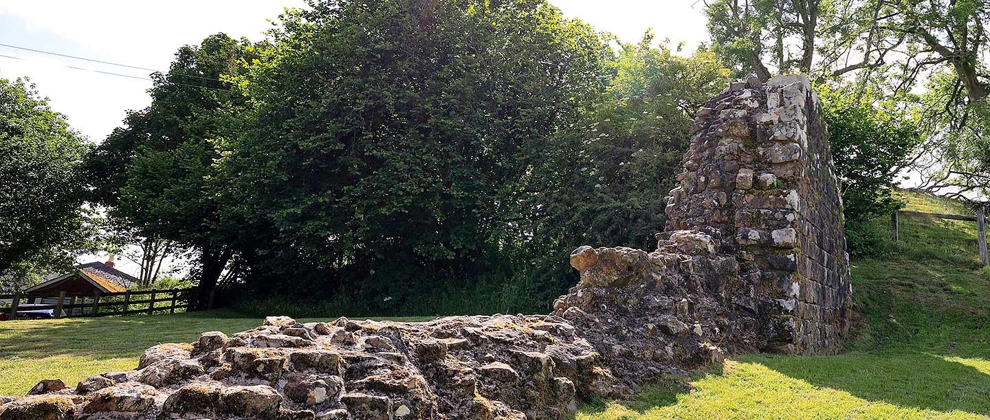
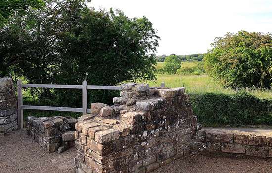
The Romans built Hadrian’s Wall from AD 122 to define the northern edge of the province of Britannia and the north-western boundary of their empire. At Hare Hill, a short length of the Wall stands to a height of 3 metres – the highest part to survive along the entire length of Hadrian’s Wall. Its survival is intriguing, because most of the Wall stone in the area was taken away to build nearby Lanercost Priory in the 12th and 13th centuries.

Hadrian’s Wall at Hare Hill
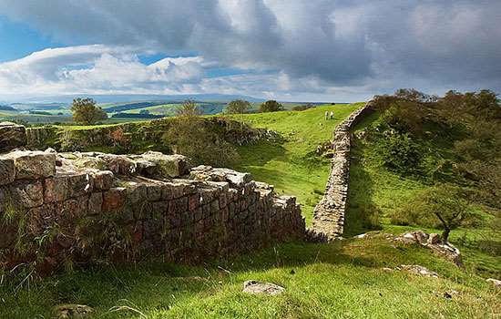
Hadrian’s Wall extends for 80 Roman miles (117.5km) from Wallsend on the river Tyne in the east to Burgh-by-Sands on the Solway Firth in the west.
Hare Hill lies in the 53rd Roman mile of the Wall east of Wallsend. Originally, the Wall here was part of the 30-mile stretch between the river Irthing and Bowness-on-Solway which was made of turf.
Towards the end of Hadrian’s reign (AD 117–38), this was replaced by a stone wall 2.32 metres wide. Hare Hill is a small section of this, surviving up to 3 metres high – approximately two-thirds of the original full height of about 4.5 metres.
Building the Wall
Three Roman legions, some 15,000 soldiers, undertook the building work on Hadrian’s Wall, beginning in AD 122: the 20th Valeria Victrix, based at Chester, the 6th Victrix, based at York, and the 2nd Augusta, based at Caerleon. These legions provided working parties, rotated periodically, leaving others to fulfil military needs in their bases and elsewhere in Britain. Each legion was made up of smaller units called cohorts, which were subdivided into centuries of around 80 soldiers, each commanded by a centurion.
From finds of inscribed ‘centurial’ stones along the Wall, we know that centuries worked as individual teams to build specific sections. One such stone was found near Moneyholes, about half a mile away, and brought to Hare Hill in the late 19th century. It can still be seen, though very faintly, built into the east end of the north face of the Wall in the ninth course up from the base.
It is inscribed ‘> P. P. ’ – the first letters of the words ‘centuria primi pili’, meaning ‘the century of the senior centurion [built this]’, thereby recording the work of 80 men under the command of the senior centurion of a whole legion.
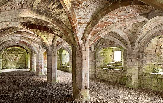
The medieval landscape of Lanercost Priory
The survival of such a tall but short length of Hadrian’s Wall is unusual in an area where it was otherwise removed long ago by stone robbing. In 2004, an archaeological excavation a few metres east of the surviving section revealed that Hadrian’s Wall had been robbed right to its foundation locally and after some time, another smaller, unmortared wall, 1 metre (3ft 6in) wide, built over its line.
The explanation might be that Hadrian’s Wall was largely destroyed locally and its stone used in building Lanercost Priory, only ¾ mile to the south-west, from about 1165. After some time, possibly in the 14th century, the smaller drystone wall was built along the northern boundary of the priory’s agricultural estate. This wall’s straight course is still visible in a low rubble line that marks the robbed-out course of Hadrian’s Wall.
It is possible that the section of Wall at Hare Hill survived the stone robbers because it formed part of a medieval building, against which the priory boundary wall was later built. The building may have been in a small hamlet.
Preserving the Wall at Hare Hill
In 1879, only the rubble core of Hadrian’s Wall survived at Hare Hill, as the facing stones had all been removed for local buildings and field walls. Its present north face resulted from restoration in the later 19th century, when fallen Roman facing stones were collected and put in place, together with the centurial stone.
This restoration was organised by the landowner, George Howard, the 9th Earl of Carlisle, using a Mr Marshall as his architect. The earl had a country house at Naworth Castle, 1½ miles south of Hare Hill, and was a founder member of the Society for the Protection of Ancient Buildings (1877).
Further conservation work took place in 1972 when the site was taken into state guardianship, and again after the excavation in 2004.
By Paul Pattison
Find out more
Hare Hill is 3½ miles west of Birdoswald Roman Fort, where interactive displays introduce the Wall and tell the whole story of Roman Britain. Closer to hand, a well-preserved turret can be seen at Banks East (no. 52b), only 0.6 miles east of Hare Hill.
-
Hadrian’s Wall: History and Stories
Discover the histories and stories associated with English Heritage’s sites along Hadrian’s Wall, the Roman empire’s north-west frontier.
-
Visit Birdoswald
Birdoswald has the best-preserved defences of any Wall fort, while just outside it is the longest continuous stretch of Hadrian’s Wall visible today.
-
Visit Banks East Turret
This imposing and well-preserved turret with adjoining stretches of Hadrian’s Wall is just a stone’s throw from Hare Hill.
-
Visit Pike Hill Signal Tower
The remains of one of a network of signal towers pre-dating Hadrian’s Wall, Pike Hill was later joined to the Wall at an angle of 45 degrees.
-
Visit Lanercost Priory
Lanercost Priory lay in the turbulent border region between England and Scotland, which would dictate its fortunes over the next 400 years.
-
Buy the guidebook to Hadrian’s Wall
The English Heritage guidebook to the Wall provides maps, plans and tours of all the key sites, as well as a history of the Wall and its forts.