History of Poltross Burn Milecastle
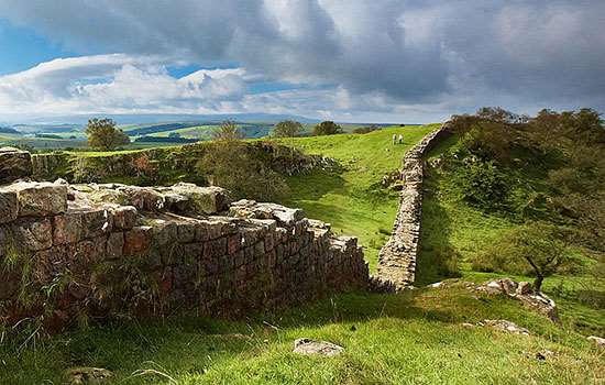
Poltross Burn (milecastle 48) is one of the best-preserved milecastles, or small forts, along Hadrian’s Wall – the frontier built from AD 122 to define the north-west limit of the Roman Empire. Milecastles were built along the Wall, about 1 Roman mile (1.48km) apart, incorporating gateways to allow and monitor access into and out of the Roman province of Britannia.
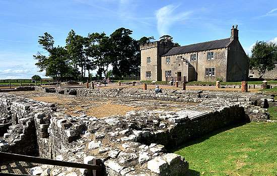
A little larger than most milecastles, Poltross Burn was in use from the AD 120s into the 4th century. Inside its perimeter wall the remains of two buildings, a stair to the rampart walk, the remains of the north gateway and an oven survive.
Roman Milecastles
Milecastles were part of the original design for Hadrian’s Wall before a major change of plan – to incorporate large forts on the Wall – was made part way through its construction.
Each milecastle covered a gateway through the Wall and would have allowed soldiers to patrol to the north. Civilians may also have moved in and out of the Roman province via these gates. Each milecastle probably had a garrison of between 10 and 30 soldiers.
Milecastles have a recognisable overall design. They are small rectangular walled enclosures, between 15 and 18 metres along one internal side and 17–23 metres on the other. Some have their longer axis parallel to the Wall (the short axis type) and others have it perpendicular to the Wall (the long axis type). They vary in detail, particularly in the design of their gates and the number and type of internal buildings. There were gates in the north and south walls: the northern ones were probably surmounted by towers. There may have been buildings just outside the walls of milecastles too, although this has not been widely studied.
The term ‘milecastle’ was first applied to these small forts in the early 18th century. From the late 19th century, they have been numbered from 1 to 80, beginning at Wallsend at the eastern end of Hadrian’s Wall. Many have been excavated but only six have substantial remains visible. English Heritage is responsible for four of these: Sewingshields (35), Cawfields (42), Poltross Burn (48) and Harrows Scar (49), plus one other at Grindon (34), where there are no remains above ground. The outlines of several more can be seen as earthworks along the Wall.
Poltross Burn’s layout
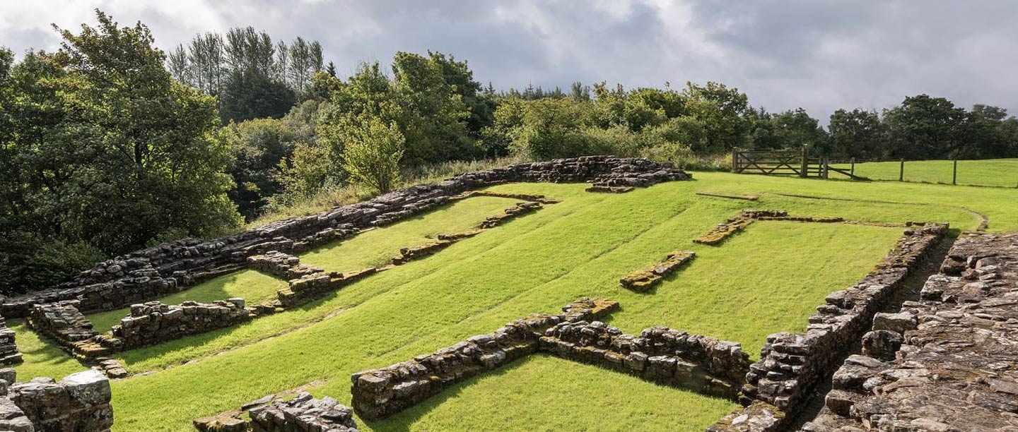
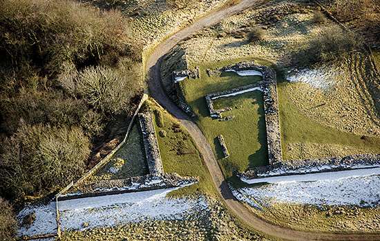
This milecastle occupies a strategic position on the western edge of a steep, narrow ravine where Hadrian’s Wall crosses the fast-flowing, rocky Poltross Burn, a tributary of the river Irthing.
Archaeological excavations have demonstrated that there was a Roman presence at the milecastle from the earliest days of Hadrian’s frontier, in the AD 120s, into the 4th century.
The milecastle is built on a moderate slope descending to Hadrian’s Wall, which forms its north wall. Its wide stone wall was pierced by gateways in the south and north sides, linked by a paved road that passed through the centre of the milecastle. On each side of the road was a rectangular building – thought to be barracks and stores – serving an estimated 30 soldiers in all. Both buildings probably had pitched roofs covered in stone slates, with pathways by the roadside sheltered by verandas.
A reconstruction drawing of the milecastle at Poltross Burn as it may have looked around AD 170. Because the structure was built on a slope, the internal buildings had to be terraced and stepped to form usable rooms with level floors. The ravine of the Poltross Burn is visible at centre right, with Hadrian’s Wall heading east beyond
© Historic England (illustration by Peter Lorimer)
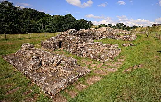
The barracks almost fill the internal space, but there was room in the north-west corner for a cooking area with a round oven, and in the north-east corner there was a stone stairway that ascended to a walkway around the top of the milecastle wall. Soldiers on this walkway were protected by a crenellated parapet. The surviving part of the stairway and its angle suggest that the wall-walk was about 3.66 metres above the ground: with a parapet, that would give an external height for the milecastle wall of about 5.34 metres.
The northern gate is the better preserved of the two: its very substantial masonry could comfortably have borne the weight of a tower.
Development and excavation
Excavations here in 1886, 1909–10 and 1965–6 revealed many modifications to the buildings in their lifetimes. Most importantly, each barrack was originally partitioned into four rooms, but these were at some time reorganised to make three larger rooms instead.
The gateways, built for double gates, were later narrowed to single portals by inserting stone blocking walls, possibly to allow only pedestrian access. Five successive ovens had each been built over the foundations of their predecessor.
Finds made during the excavations include items of personal adornment such as a brooch and a jasper intaglio (a small inset) from a finger ring. There was also practical military gear, notably the metal chape from the bottom of a leather sword scabbard and several pieces of scale armour. Items of horse harness indicate that at some time mounted soldiers may have been garrisoned here.
By the early 19th century, the milecastle had become known locally as ‘the King’s Stables’.
By Paul Pattison
The Wall nearby
From Poltross Burn, it’s possible to walk an almost unbroken stretch of Hadrian’s Wall for 2 miles (3km) westwards, taking in the Roman bridge abutment at Willowford, three turrets, Harrows Scar Milecastle and Birdoswald Roman Fort.
-
Visit Willowford Wall, Turrets and Bridge
This fine 914-metre long stretch of Wall, including two turrets and bridge remains beside the Irthing, is linked by a bridge to Birdoswald Roman Fort.
-
Visit Harrows Scar Milecastle
A mile-long section of the Wall, rebuilt in stone later in Hadrian's reign, which survives up to 2 metres high and contains a number of Roman inscriptions.
-
Visit Birdoswald Roman Fort
Birdoswald remained in occupation throughout the Roman period, and its defences are the best preserved of any along the Wall.
More about Hadrian’s Wall
-
Hadrian’s Wall: History and Stories
Discover the histories and stories associated with English Heritage’s sites along Hadrian’s Wall, the Roman empire’s north-west frontier.
-
Emperor Hadrian
Emperor Hadrian focused on securing the empire’s existing borders, and Hadrian’s Wall was the most impressive statement of this policy.
-
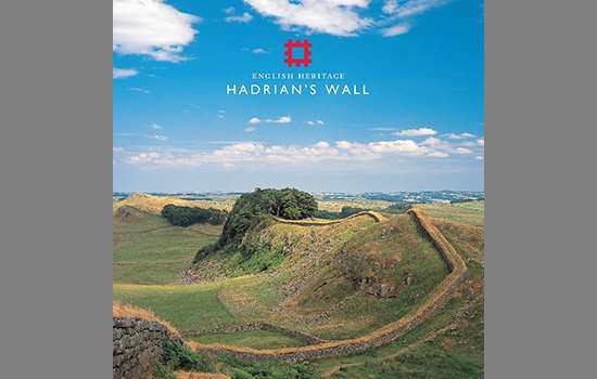
Buy the guidebook to Hadrian’s Wall
The English Heritage guidebook to the Wall provides maps, plans and tours of all the key sites, as well as a history of the Wall and its forts.
-
MORE HISTORIES
Delve into our history pages to discover more about our sites, how they have changed over time, and who made them what they are today.